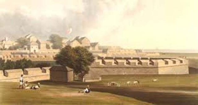
Fort area was mainly known as the Bombay city in the history and today known as a popular part of town area. Other famous places in and around Fort area is Bombay Stock Exchange, Kala Ghoda, Churchgate station, CSMT railway station, Flora fountain and many more.
There was a marriage treaty between Portuguese and Britishers. In 1661 Prince Charles II of England was married to Infanta Catherine de Braganza, sister of the King of Portugal. Under this treaty the Bombay island was gifted as dowry by the Portuguese to the British.
After the handover of Bombay islands in 1665, the Deputy British Viceroy Humphrey Cooke, after taking the charge, he built a 50 metres fort wall installing upto 20 cannons on it. This was the first step of defence against the Marathas and the Dutch.
In 1715 the fort was expanded by Charles Boone, the Governor of Bombay. It was completed in 1722 with three gates: 1) Bazar gate (opposite GPO).2) Church gate (near Flora fountain) 3) Apollo gate (between St.Andrew’s Church and Rampart Row). That time the Fort area was considered as main city. It was built to protect city from invasion of Marathas. After thirty years for more safety purpose a ditch was constructed around the fort.
Until the mid-nineteenth century, Mumbai meant essentially the Fort and outside it were numerous villages like Mazagaon, Byculla, Mahim and Matunga. Outside the Fort walls was the ‘Black Town’ set amidst coconut trees. This also included the present. Girgaon and Bhuleshwar areas.
The Fort Wall, with its twelve bastions mounted with guns, ran from the sea to the Lion Gate then westwards upto the present University buildings and turned north, following Mahatma Gandhi Road (Honrby Road) upto V.T., then turning towards the east, joined the Fort St. George.
St. George Fort
St. George Fort is located in South Mumbai of Fort Area. It was constructed to honour King George III of England. The hill on which the Dongri Fort stood was razed and St. George Fort was built in its place.
Presently, the fort is headquarters of the Archaeological Survey of India and restored. Below photo is remains of the old fort of St. George in Mumbai near St. George Hospital. [image source: wikimedia – Own work]
Below is the Bombay Fort map (Source: Wikimedia)

All Europeans coming by sea route use to enter through the Apollo Gate which was situated near the present Lion Gate. Other two gates where Churchgate and Bazaar Gate. The name Churchgate suggest that gate was present somewhere near where the Flora fountain to enter St. Thomas Cathedral Church.
No one was allowed to enter the city after sunset under any circumstances and anyone coming late had to spend the night outside the walls of the Fort. The city looked dead after seven in the evening. In order to indicate the time of sunset and sunrise, guns were fired.
Outside the city was the spacious Esplande (shown in first photo above) that stretched like a large even sheet of green earth from the fort wall to Back Bay and from Cooperage to Grant Road. On this vast space, parts of which are still retained in the forms of maidans, was the European Golf course.
The Fort wall were destroyed
All this suddenly underwent a change with the pulling down of the wall in 1862-63. Due to increase in trade the population was increasing. So as per city expansion plan, the fort wallls were destroyed by the Governor Sir Bartle Frere (Governor from 1862 to 1867).
The ditch was filled. The city, as if released from a long confinement, began to stretch itself across the Esplande, where imposing structures began to rise, marking the beginning of modern Mumbai.
The town was so small that it was only a mile long from Apollo Gate to the Bazaar and about two furlongs broad from Church Gate to the Bunder which can be identified with today’s Fort area.
Also read:
111 Year Old Ismail Building in Fort Area


[…] the town that time. The church was named in honour of Saint Thomas the Apostle. It is located near Fort area, Hornimon […]
[…] circle is located at the prime location situated in the Fort area of South Mumbai. The Horniman Circle Gardens represent lush greenery surrounded by grand buildings. […]
Comments are closed.