

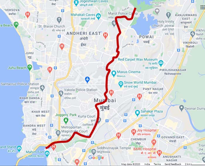
Mumbai city made from uniting seven islands and it is spread over 603.4 sq km. There are 4 rivers flowing through the city. The Mithi river came into the limelight when Mumbai experienced torrential rain and flooding in July 2005. Mithi river failed to discharge stormwater causing heavy flooding in Mumbai.
The four rivers are Dahisar River, Poisar river, Oshiwara river and Mith river. (The below river map is just for indicative purpose and it’s not scaled to perfection)
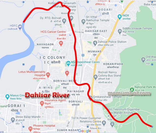
Dahisar River :
Dahisar river is 12km originated in the Tulsi lake near Sanjay Gandhi National Park. The river stretches from the park running through Sri Krishnanagar, under the Dahisar bridge moving through Daulat Nagar, Kandar pada and finally entering Arabian sea through Gorai creek. Till the late 1960s condition was good where crocodiles were witnessed to be residing in the river. Later due to encroachments, dumping of industrial waster and sewage from slums, river became highly polluted.
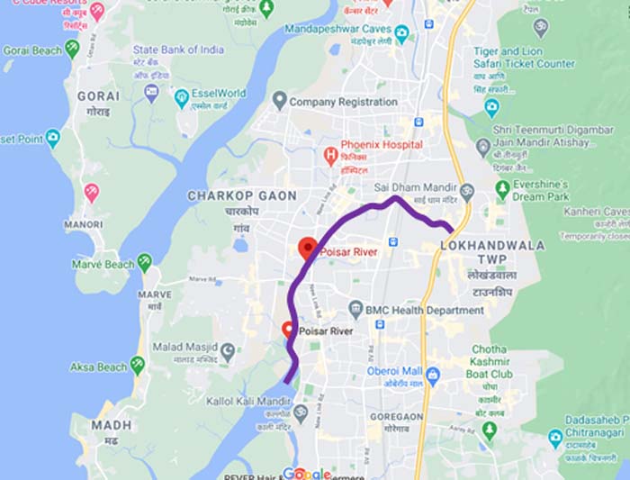
Poisar River: a river in Mumbai, India. It starts in the Sanjay Gandhi National Park and empties into the Marve Creek and ends into the Arabian Sea. This river is now nothing than an urban stream when it begins and is contaminated with industrial liquid wastes and sewage. There was a time when the water was clean and the people used to use it for household purposes. A group of citizens called ‘River Marchers’ removed nearly 1.7 lakh kilos of waste from Mumbai’s Poisar river.
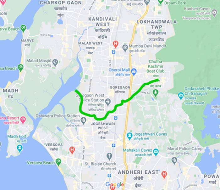
Oshiwara River : It begins from the Aarey Milk Colony, goes directly into the Goregaon hills, beyond the Aarey Milk Colony and gets clear into the Malad Creek, the efforts have started to widen and clean up of the river. Proposals like converting it into a waterway for transportation, setting up small farms on its banks and introduce gaseous fuel plants to convert waste into energy and use its slurry for manure for agriculture purpose.
Mithi River : It is a confluence of tail-water discharges of the Powai and Vihar lakes. The river is seasonal and rises during the monsoons. The overflowing lakes also contribute to the river flow, which is stopped by a dam. It is also well known that the Mahim bay area, where Mithi River meets Arabian Sea. It is nominated bird sanctuary where migratory birds come for nesting. This part is full of trees and shrubs. This river used to serve as an important storm water drain for Mumbai but, as it has been used as a waste matter over the years, its importance as to drain away excess water and reduced it, but it posed danger during high tide bringing polluted water into the city and flooding the city, the river was not as contaminated as it is today.


[…] Rivers of Mumbai […]
[…] Read about rivers in Mumbai […]
Comments are closed.