
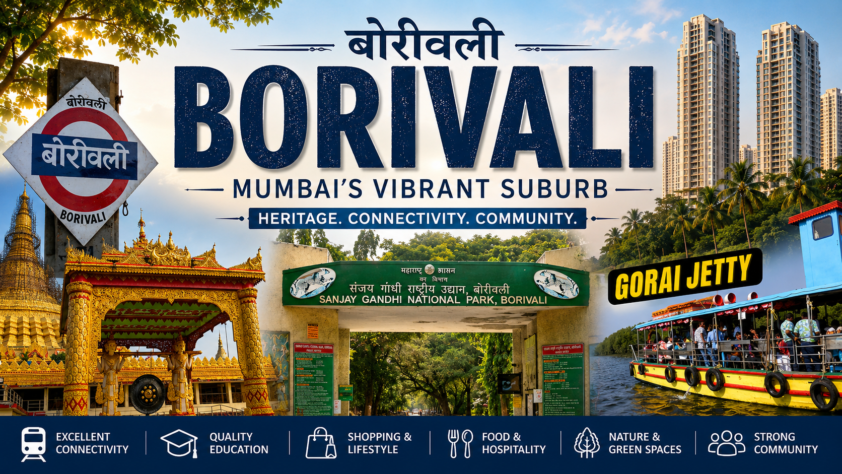
Borivali is one of the most important and well-established suburbs of north-west Mumbai. Located at the northern end of Mumbai's western suburban corridor, Borivali is broadly divided into Borivali East and Borivali West.
The locality is known for its excellent railway and road connectivity, established residential neighbourhoods, schools, colleges, hospitals, shopping areas and restaurants. What makes Borivali particularly distinctive is its proximity to the Sanjay Gandhi National Park and the historic Kanheri Caves.
Borivali is also an important railway hub, with Borivali Railway Station serving as an originating and terminating point for several suburban services. At the same time, rapid redevelopment, increasing residential density and growing traffic are changing the character of the suburb.
Table of Contents
- Overview
- History of Borivali
- Borivali East and Borivali West
- Railway & Road Connectivity
- Communities & Changing Character of Borivali
- Crowding, Traffic & Urban Growth
- Religious Places
- Schools & Colleges
- Markets & Shopping
- Restaurants & Cafes
- Hotels & Stay
- Sanjay Gandhi National Park & Places to Visit
- Hospitals
- Residential Areas
- Property Rates & Rentals
- Employment & Commercial Areas
1. Overview
Borivali is one of the major residential suburbs of Mumbai's western corridor. It lies between Dahisar to the north and Kandivali to the south, with the Sanjay Gandhi National Park forming a major natural boundary on the eastern side.
The suburb has developed from a collection of older villages and settlements into a densely populated urban area with high-rise residential buildings, established housing societies, commercial streets and extensive civic infrastructure.
Borivali West is generally more densely built around the railway station, S.V. Road, IC Colony and the older neighbourhoods, while Borivali East extends towards the Western Express Highway, Sanjay Gandhi National Park and several newer residential developments.
The presence of the National Park, Kanheri Caves, old village settlements and historic religious institutions gives Borivali a character that is different from many other highly urbanised Mumbai suburbs.
2. History of Borivali
Borivali has a much older history than its present-day high-rise skyline suggests. The area was historically part of Salsette and developed through a number of villages and settlements.
Historical records refer to Borivali as an established settlement and railway location. The development of the railway played an important role in transforming Borivali from a relatively rural settlement into an important Mumbai suburb.
The suburban railway line was electrified between Colaba and Borivali in 1928, while the Borivali–Virar section was electrified in 1936. Railway connectivity subsequently encouraged residential and commercial development in the northern suburbs.
Borivali was incorporated into the municipal limits of Bombay in 1957, marking another important stage in its integration with the growing city.
Several older settlements and heritage areas remain associated with Borivali, including Babhai, Eksar, Poisar, Shimpoli, Vazira, Magathane, Dattapada, Gorai and Mount Poinsur.
The historic Kanheri Caves and Mandapeshwar Caves provide evidence of the area's much older religious and cultural history.
3. Borivali East and Borivali West
Borivali West
Borivali West is the older and more intensively developed side of the railway station. It contains established residential societies, traditional markets, schools, religious institutions, restaurants and local businesses.
Important neighbourhoods include:
- IC Colony
- LIC Colony
- Yogi Nagar
- Chikuwadi
- Shimpoli
- Babhai
- Vazira
- Eksar
- Gorai
Several older village settlements and heritage structures survive in parts of Borivali West, particularly around Babhai, Jambli Gully and the Mount Poinsur area.
Borivali East
Borivali East extends towards the Western Express Highway and Sanjay Gandhi National Park. It contains a mixture of established neighbourhoods, older settlements and newer high-rise residential developments.
Important areas include:
- Magathane
- Dattapada
- Rajendra Nagar
- Nancy Colony
- Shantivan
- Devipada
- Kulupwadi
- Carter Road area
Its proximity to the highway and the National Park has made Borivali East an important residential growth area.
4. Railway & Road Connectivity
Borivali Railway Station
Borivali Railway Station (BVI) is one of the major stations on the Western Railway suburban network. Western Railway classifies Borivali as an SG-1 station on the Mumbai Division.
Borivali has a particularly important advantage for daily commuters: it is an originating and terminating station for suburban services. This means passengers travelling towards Churchgate and South Mumbai can board several trains from Borivali itself rather than joining a train at a station farther north.
This originating-train facility is one of the reasons Borivali remains an important residential choice for people commuting towards the central western and southern parts of Mumbai.
Borivali also handles selected long-distance and intercity services, adding to its importance as a transport hub.
Major Road Connections
- Western Express Highway: Major north-south arterial road on the eastern side of Borivali.
- S.V. Road: Important north-south road through Borivali West.
- Link Road: Major road connecting Borivali West with Kandivali and Dahisar.
- Gorai Road: Provides access towards Gorai and the western coastal belt.
- Chandavarkar Road: Important internal road in Borivali West.
- Shimpoli Road: Major road serving residential areas in western Borivali.
Metro Connectivity
Borivali benefits from the wider western-suburban Metro network, particularly Metro Line 2A, which runs along the western suburbs and improves east-west and north-south connectivity with interchange options.
5. Communities & Changing Character of Borivali
Borivali's population has changed significantly as the suburb developed from a collection of villages into a major urban residential centre.
The older settlements included Koli, East Indian and other traditional communities. The historic villages around Gorai and the western coastal belt retain elements of this older social character.
With the growth of Mumbai, Borivali attracted residents from different parts of Maharashtra and other parts of India. Today the suburb has a socially diverse population that includes:
- Marathi-speaking communities
- Gujarati communities
- Jain communities
- Catholic and other Christian communities
- Koli and East Indian families in older settlements
- Residents from other parts of Maharashtra
- Residents who have migrated to Mumbai from different parts of India
IC Colony is particularly associated with Mumbai's Catholic community and has developed around the historic Our Lady of Immaculate Conception Church.
Borivali's present-day identity is therefore not associated with one community. It is a mixed suburban population shaped by several generations of migration, redevelopment and urban expansion.
6. Crowding, Traffic & Urban Growth
Borivali has changed from a relatively low-density suburban settlement into a heavily urbanised residential area.
Older Borivali included orchards, large houses, village settlements and low-rise buildings. Much of this landscape has gradually been replaced by multi-storey residential buildings, redevelopment projects and commercial development.
The pressure is particularly noticeable around:
- Borivali Railway Station
- S.V. Road
- Chandavarkar Road
- Link Road
- Western Express Highway approaches
- Major junctions connecting Borivali East and West
The growing number of residential projects has increased population density, vehicular movement and demand for parking and public transport.
At the same time, redevelopment is changing several established neighbourhoods. Older buildings and low-rise structures are gradually being replaced by larger residential projects.
This creates a noticeable contrast within Borivali: some internal neighbourhoods such as parts of IC Colony and older village areas retain a relatively quieter character, while areas surrounding the railway station and major roads can be highly congested.
The redevelopment of Borivali Railway Station is also expected to address increasing passenger movement and the need for improved station infrastructure.
7. Religious Places
Our Lady of Immaculate Conception Church – IC Church
Our Lady of Immaculate Conception Church is one of the best-known landmarks of IC Colony and an important centre of the Catholic community in Borivali.
Address: IC Colony, Borivali West, Mumbai – 400103.
Mandapeshwar Cave Temple
Mandapeshwar is an important historical and religious site around Mount Poinsur. The rock-cut cave complex contains a Shiva shrine and is an important part of Borivali's heritage.
Jain Temples
Borivali has a well-established Jain community and several Jain religious institutions. The heritage inventory also records the Shri Sambhavnath Jain Temple around Jambli Gully in Borivali West.
Local Hindu Temples
Several temples serve the residential communities of Borivali, including neighbourhoods around Magathane, Shimpoli, Yogi Nagar and the older market areas.
8. Schools & Colleges
Borivali has a large number of educational institutions. The following table highlights selected established institutions located within Borivali.
Schools in Borivali
| School | Address | Details |
|---|---|---|
| St. Anne's High School | L.T. Road, Borivali West, Mumbai – 400092 | Established school serving the Borivali West area. |
| Don Bosco High School & Junior College | Vazira Naka, Borivali West, Mumbai – 400091 | School and junior college institution serving students in Borivali and surrounding areas. |
| Mary Immaculate Girls' High School & Junior College | Mount Poinsur, Borivali West, Mumbai – 400103 | Girls' school and junior college located in the Mount Poinsur area. |
| VIBGYOR High School – Borivali | Holy Cross Road, IC Colony, Borivali West, Mumbai – 400103 | International-school group campus located in IC Colony. |
| Narayana e-Techno School – Borivali | Shanti Ashram Road, Devki Nagar, Borivali, Mumbai – 400103 | CBSE school serving the Borivali area. |
| ORCHIDS The International School – Borivali | Plot 3/3A, RSC, Shimpoli Road, Gorai-1, Borivali West, Mumbai – 400091 | International-school campus in the Shimpoli/Gorai area. |
Colleges in Borivali
| College | Address | Details |
|---|---|---|
| R.R. International College | Kalpana Chawla Marg, behind Shanti Ashram Bus Depot, IC Colony, Borivali West, Mumbai – 400103 | Higher education institution located in IC Colony. |
| Nalanda Law College | Plot No. 2, RSC 34, near Mangalmurti Hospital, Gorai-II, Borivali West, Mumbai – 400091 | Offers B.A. LL.B., LL.B. and LL.M. programmes affiliated with the University of Mumbai. |
Note: Several well-known colleges frequently associated with Borivali residents are actually located in neighbouring Kandivali. They should therefore be listed separately rather than described as Borivali colleges.
9. Markets & Shopping
Borivali Station Market
The area immediately surrounding Borivali Railway Station is one of the suburb's most active traditional shopping areas. It serves commuters as well as residents from Borivali West and Borivali East.
Jambli Gully
Jambli Gully is one of the traditional shopping areas of Borivali West. The area is known for local retail and forms part of the older commercial fabric of Borivali.
IC Colony Market
IC Colony has a strong neighbourhood shopping network serving its residential population. Supermarkets, bakeries, pharmacies, speciality stores and everyday retail outlets are distributed throughout the locality.
Chandavarkar Road
Chandavarkar Road is an important shopping and residential corridor connecting several parts of Borivali West.
Link Road
Link Road provides access to a large number of retail outlets, shopping centres, restaurants and everyday services in western Borivali.
Malls & Shopping Centres
| Shopping Centre | Location | Details |
|---|---|---|
| Raghuleela Mega Mall | Borivali West | Major organised shopping centre serving Borivali and nearby suburbs. |
| Xth Central Mall | Borivali West | Shopping and retail destination in western Borivali. |
Note: Growel's 101 is in Kandivali East and is therefore not included as a Borivali shopping centre.
10. Restaurants & Cafes
Borivali has a large and varied food scene, particularly around Borivali West, IC Colony, S.V. Road, Link Road and the railway station area. The following are examples of identifiable restaurants within Borivali.
| Restaurant | Address | Type / Details |
|---|---|---|
| Borivali Banjara Family Restaurant & Party Hall | CTS No. 552/B, Holy Cross Road, opposite Philips Tower, IC Colony, Borivali West, Mumbai – 400103 | Indian restaurant and family dining with party-hall facilities. |
| The Fusion Kitchen | Shop No. 1, Holy Cross Road, opposite Veda Apartment, IC Colony, Kandarpada, Borivali West, Mumbai – 400103 | Restaurant offering a multi-cuisine/continental-oriented menu. |
| The Jungle Family Restaurant & Party Hall | Holy Cross Road, opposite Borivali Banjara, IC Colony, Borivali West, Mumbai – 400103 | Family restaurant and party-hall venue. |
| MASTEE Pure Veg Restaurant | Shop 4, Ground Floor, AHCL Homes, New Link Road, opposite Shimpoli, Borivali, Mumbai – 400092 | Pure vegetarian restaurant. |
This is a representative list rather than an exhaustive restaurant directory. A separate Borivali food guide can later provide a much larger searchable list of restaurants, cafes, bakeries and street-food destinations.
11. Hotels & Stay
Borivali is not primarily a tourist hotel district, but it has a number of hotels and accommodation options for business travellers, visitors to northern Mumbai, people visiting relatives and passengers requiring short stays.
| Hotel | Address | Details |
|---|---|---|
| The Byke Business – Delotel | Survey 2912/2913, Chandavarkar Road, Borivali West, Mumbai – 400092 | Business-oriented hotel in Borivali West. |
| Hotel Granville | Plot 680/D, opposite Kora Kendra Ground, R.M. Bhattad Road, Borivali West, Mumbai – 400092 | Hotel accommodation in western Borivali. |
| The Grandeur Boutique Hotel | New Link Road, Yogi Nagar, Borivali West, Mumbai – 400091 | Boutique-style accommodation in Yogi Nagar. |
| Hotel Nice Stay | First Floor, Kasturba Road No. 1, behind Kasturba Police Station, Chinchpada, Borivali East, Mumbai – 400066 | Budget accommodation in Borivali East. |
| Hotel Artilla Borivali | CTS 19/151, Kripa Dham Society, Plot No. 38/41, Gorai Road, Borivali West, Mumbai – 400091 | Hotel accommodation towards Gorai Road. |
12. Sanjay Gandhi National Park & Places to Visit
Sanjay Gandhi National Park
The Sanjay Gandhi National Park is Borivali's most important natural attraction. The large protected forest area lies immediately east of the built-up suburb and provides an unusual green landscape within metropolitan Mumbai.
The Borivali entrance is particularly accessible from Borivali Railway Station, making the National Park one of the easiest major natural attractions in Mumbai to reach by suburban train.
Kanheri Caves
Located within Sanjay Gandhi National Park, the Kanheri Caves are an ancient Buddhist rock-cut cave complex and one of Mumbai's most important archaeological sites.
The caves contain numerous excavated structures, sculptures, inscriptions and monastic remains and represent the long Buddhist history of the region.
Mandapeshwar Caves
Mandapeshwar Caves are located around Mount Poinsur in Borivali West. The historic rock-cut complex is associated with a Shiva shrine and is an important part of Borivali's heritage landscape.
Gorai
Gorai lies towards the western side of Borivali and provides access to the wider Gorai–Manori coastal belt.
Places associated with this side of Borivali include:
- Gorai Beach
- Manori
- Global Vipassana Pagoda
- The former EsselWorld and Water Kingdom entertainment zone
13. Hospitals
Borivali has several hospitals and healthcare institutions serving both the local population and surrounding suburbs.
Shri Harilal Bhagwati Municipal General Hospital
Address: S.V.P. Road, Borivali West, Mumbai – 400103.
Bhagwati Hospital is a major municipal healthcare facility serving Borivali and surrounding areas.
Karuna Hospital
Address: Jeevan Bima Nagar, near Bhagwati Hospital, Borivali West, Mumbai – 400103.
Karuna Hospital provides a range of medical services and specialties and is located close to the Bhagwati Hospital healthcare cluster.
Other Healthcare Facilities
Borivali also has numerous private hospitals, nursing homes, diagnostic centres, dental clinics and speciality medical facilities distributed throughout Borivali East and West.
14. Residential Areas
Borivali has a diverse residential landscape ranging from older village settlements and cooperative housing societies to modern high-rise developments.
IC Colony
IC Colony is one of Borivali's best-known residential neighbourhoods. It is recognised for its greenery, Catholic heritage, schools, churches and established residential character.
LIC Colony
LIC Colony is an established residential area with convenient access to the major roads and shopping areas of Borivali West.
Yogi Nagar
Yogi Nagar is a densely developed residential locality close to New Link Road and has good access to shops, restaurants and everyday services.
Chikuwadi
Chikuwadi is an established residential pocket containing older societies as well as newer residential development.
Shimpoli
Shimpoli has experienced substantial residential growth and contains newer apartment developments along with schools, restaurants and local amenities.
Babhai
Babhai is one of the older settlements of Borivali West. Elements of its traditional settlement character remain alongside modern residential redevelopment.
Gorai
Gorai has a distinctive character because of its older village environment, coastal location and newer residential development.
Borivali East
Borivali East contains a mixture of older settlements and modern residential developments around Magathane, Dattapada, Rajendra Nagar, Nancy Colony and the areas adjoining the National Park.
15. Property Rates & Rentals
Borivali has a substantial residential property market covering older cooperative societies, redeveloped buildings, premium apartments and newer high-rise projects.
Property prices differ considerably according to the exact locality, distance from the railway station, building age, redevelopment status, floor, amenities, parking and road connectivity.
Indicative Property Market
| Area | Indicative Market Level | Remarks |
|---|---|---|
| Borivali Overall | Around ?25,000 per sq. ft. | Indicative online market average; varies substantially by project and micro-locality. |
| Borivali West | Around ?24,700–?25,000 per sq. ft. | Established residential market with significant variation between neighbourhoods. |
| Borivali East | Around ?25,000–?26,000 per sq. ft. | Strong demand around highway, railway and newer residential developments. |
Important: These are indicative property-market figures from online property portals and should not be treated as official government valuation or guaranteed transaction prices. Actual prices can vary significantly between individual buildings and transactions.
Rental demand remains supported by Borivali's railway connectivity, schools, hospitals, established residential infrastructure and access to employment centres in Kandivali, Malad, Goregaon and Andheri.
16. Employment & Commercial Areas
Borivali is primarily a residential and local commercial centre rather than one of Mumbai's largest corporate employment districts.
The local economy includes:
- Retail and wholesale businesses
- Banking and financial services
- Healthcare
- Education
- Restaurants and food businesses
- Professional services
- Real estate
- Small and medium businesses
- Coaching and training institutes
For larger corporate employment opportunities, Borivali residents commonly commute towards nearby employment centres such as Kandivali, Malad, Goregaon and Andheri.
The Western Railway and Western Express Highway make these employment centres accessible from Borivali, although peak-hour crowding remains a significant part of daily commuting.
Sources & References
The factual information in this guide should be maintained with periodic verification because addresses, businesses, transport services and property-market figures can change.
- Western Railway – Indian Railways
- Maharashtra State Gazetteers
- Mumbai Metropolitan Region Heritage Conservation Society
- Municipal Corporation of Greater Mumbai (BMC)
- Official websites of individual schools and colleges
- Current property-market data from established property portals
- Current business and hotel listings for establishment addresses
Check Guide for Other Places in Mumbai: