


The southwest monsoon turned highly active over Mumbai and adjoining districts during 3–4 July 2026, bringing intense rainfall across the Mumbai Metropolitan Region. The spell was triggered by two major synoptic systems:
- a well-marked low pressure area over Northwest Bay of Bengal and
- a strong offshore trough extending along the west coast.

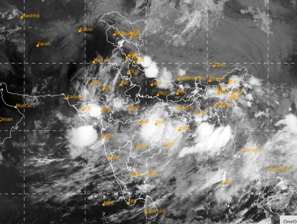
These systems enhanced moisture incursion from the Arabian Sea, leading to persistent heavy to very heavy rainfall over Mumbai, Thane, Palghar and Raigad.
The India Meteorological Department (IMD) had already warned about increased rainfall activity over Konkan during 1st – 7th July, and the forecast has verified strongly over Mumbai and nearby districts.
Below are the rainfall recorded in Mumbai on 4th July 2026: (Data source BMC & IMD Mumbai)

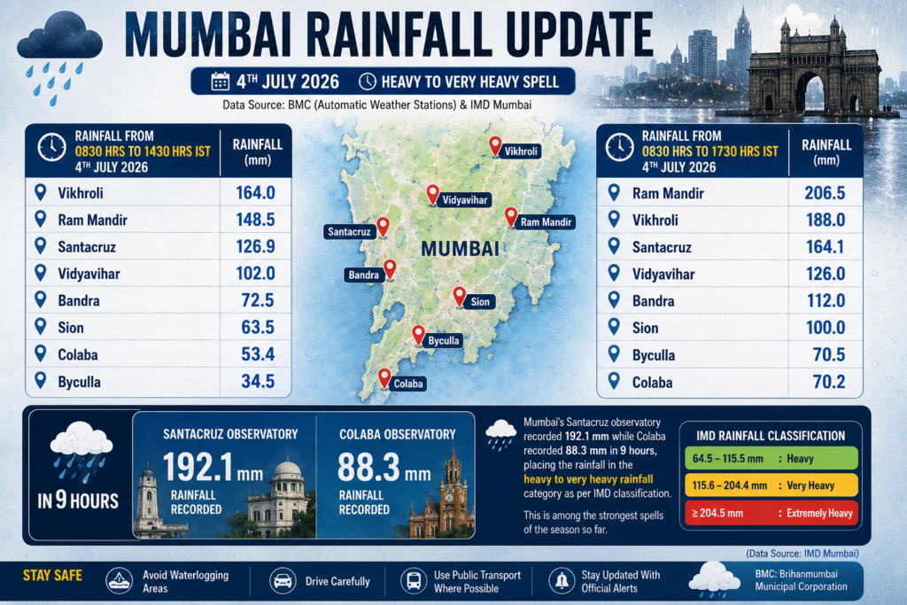
In many localities, intense spells delivered 70–100 mm rainfall within just 4–5 hours, overwhelming drainage systems and leading to severe waterlogging.
Most Affected Areas in Mumbai
The heaviest impact within Mumbai was reported from several low-lying and drainage-sensitive pockets.
Major affected areas included:
| Sion King’s Circle Dadar TT Parel Hindmata Kurla | Andheri Subway Milan Subway Bandra (East & West) Prabhadevi Powai Malad |
Several roads witnessed slow-moving traffic due to waterlogging, while suburban railway services saw delays during peak rainfall hours. Low-lying areas experienced temporary flooding as rainfall intensity exceeded drainage capacity.
Why Did Rainfall Intensify?
Meteorologically, this spell developed due to the combined effect of:
- Northwest Bay of Bengal low pressure area
- Strong offshore trough along Maharashtra–Karnataka coast
- Strong westerly moisture feed from Arabian Sea
- Favorable monsoon trough alignment
The Bay system supplied synoptic-scale support, while the offshore trough enhanced moisture convergence along the Konkan coast. This combination created ideal conditions for deep convection and prolonged heavy rainfall over Mumbai region.
When Will Conditions Improve?
According to IMD, heavy rainfall activity over Konkan, including Mumbai, is likely to continue for the next 24–48 hours, though rainfall intensity may gradually reduce after 6–7 July as the current synoptic systems weaken and shift inland.
However, intermittent heavy spells are still possible due to active monsoon conditions.
IMD Outlook:
- 5 July: Heavy to very heavy rain likely (Red Alert)
- 6 July: Moderate to heavy rain with intense spells (Orange alert)
- After 7 July: Gradual reduction in rainfall
Residents are advised to remain cautious, especially in flood-prone and low-lying areas.

